
Parcel 08-1S-23-0000-0001-0010
Owners
11895 CR 121
BRYCEVILLE, FL 32009
Parcel Summary
| Situs Address | 11895 CR 121 |
|---|---|
| Use Code | 0200: MOBILE HOME |
| Tax District | 6: Drainage Dist |
| Acreage | 1.5000 |
| Section | 8 |
| Township | 1S |
| Range | 23 |
| Subdivision | |
| Exemptions | HX: Homestead (196.031(1)(a)) (100%) HB: Homestead Banded (196.031(1)(ab) (100%) |
Short Legal
PT OF NE 1/4 OF NE 1/4LYING E OF ST RD 121
IN OR 2632/1667
Values
| 2025 Preliminary Values | 2024 Certified Values | |
|---|---|---|
| Land Value * | $67,500 | $45,000 |
| (+) Improved Value | $78,928 | $71,964 |
| (=) Market Value | $146,428 | $116,964 |
| (-) Agricultural Classification | $0 | $0 |
| County Assessed Value | $120,356 | $116,964 |
| (=) School Taxable Value *** | $95,356 | $91,964 |
| (=) County Taxable Value | $69,634 | $66,964 |
Document/Transfer/Sales History
| Instrument / Official Record | Date | Q/U | V/I | Sale Price | Ownership |
|---|---|---|---|---|---|
| WD 2632/1667 | 2023-04-11 | Q | Improved | $158,000 | Grantor: ALFORD CLINTON Grantee: CREWS SHEENA LEE |
| WD 2593/0404 | 2022-09-15 | U | Improved | $46,300 | Grantor: HANNER DUSTIN Grantee: ALFORD CLINTON |
| WD 2012/0208 | 2015-10-22 | Q | Improved | $68,000 | Grantor: HOWARD JAMES H & DONNIE R Grantee: HANNER DUSTIN |
| MS 2001/1237 | 2015-08-24 | U | Improved | $60,800 | Grantor: POWERS WILLIAM G II & DEIDRE L Grantee: HOWARD JAMES H & DONNIE R |
| WD 1901/1142 | 2014-01-30 | Q | Improved | $65,000 | Grantor: HOWARD JAMES H & DONNIE R Grantee: POWERS WILLIAM G II & DEIDRE LEE |
| WD 1892/1337 | 2013-11-11 | U | Improved | $59,700 | Grantor: GEORGE ELLEN D & SAMUEL D Grantee: HOWARD JAMES H & DONNIE R |
| WD 1759/1558 | 2011-09-23 | Q | Improved | $65,000 | Grantor: HOWARD JAMES H & DONNIE R Grantee: GEORGE ELLEN D & SAMUEL D |
| CT 1106/0147 | 2003-01-08 | U | Improved | $100 | Grantor: CLERK OF COURT Grantee: HOWARD JAMES H & DONNIE R |
| WD 0906/0965 | 1999-11-03 | U | Improved | $21,000 | Grantor: HOWARD JAMES H & DONNIE R Grantee: ROWLAND RAYMOND & NATALIE HALL |
| WD 0896/1217 | 1999-08-24 | Q | Vacant | $8,000 | Grantor: THOMPSON ROBERT D & CLAIRE A Grantee: HOWARD JAMES H & DONNIE R |
Buildings
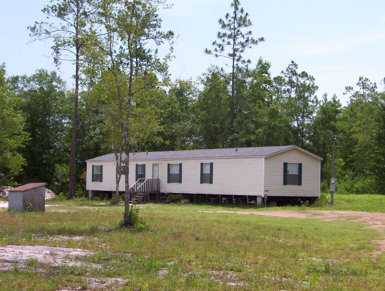
Building # 1, Section # 1, 48048, MOBILE HOME
| Heated Sq Ft | Year Built | Value |
|---|---|---|
| 1214 | 2000 | $78,928 |
Structural Elements
Land Lines
Personal Property
None
TRIM Notices
Property Record Cards
Disclaimer
The Nassau County Property Appraiser's Office makes every effort to produce the most accurate information possible. No warranties, expressed or implied, are provided for the data herein, its use or interpretation. The information contained herein is for ad valorem tax assessment purposes only. The Property Appraiser exercises strict auditing procedures to ensure validity of any transaction received and posted by this office but cannot be responsible for errors or omissions in the information received from external sources. Due to the elapsed time between transactions in the marketplace, and the time that those transactions are received from the public and/or other jurisdictions, some transactions will not be reflected.